This guide was synthesized using the latest legislative data and verified by our editorial board. Laws are subject to change; always consult official sources for final confirmation.
Suriname's natural splendor is epitomized by the Tafelberg and the Central Suriname Nature Reserve, two geographical features that offer both breathtaking landscapes and a rich tapestry of biodiversity. This article delves into the specific characteristics of Tafelberg and the Central Suriname Nature Reserve, their geographical significance, and what expatriates should know before exploring these remarkable areas.
Understanding Tafelberg's Geography
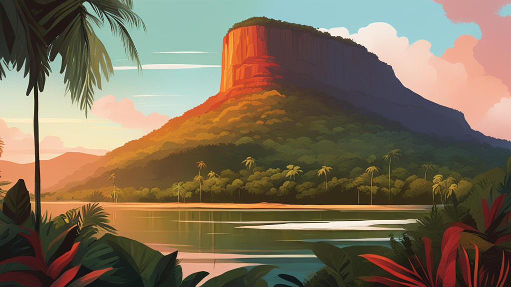
Tafelberg, which translates to "table mountain," stands at an impressive height of 1,026 meters (3,366 feet) and is notable for its distinctive flat-topped summit. Located within the Central Suriname Nature Reserve, Tafelberg is one of the easternmost *tepuis* in South America, consisting primarily of Roraima quartzite sandstone. This geological feature is an ancient remnant of a vast tableland that once covered the region. The mountain's steep slopes and unique rock formations create a striking contrast against the lush tropical rainforest that surrounds it.
The Tafelberg is situated approximately 200 kilometers (124 miles) southwest of Paramaribo, the capital city of Suriname. The journey from Paramaribo typically takes around 4-5 hours by car, followed by a short boat ride to reach the base of the mountain. This accessibility makes it a popular excursion for both locals and expats looking to explore the natural beauty of Suriname.
Unique Ecosystems and Biodiversity
The Tafelberg area is characterized by diverse ecosystems that are crucial for conservation. The mountain's unique geology and elevation create microclimates that support a variety of plant species, many of which are endemic to the region. The surrounding rainforest is home to over 5,000 vascular plant species and numerous animal species, including jaguars, giant river otters, and various primates. The rich biodiversity is not only a draw for nature enthusiasts but also plays a vital role in the ecological balance of the Central Suriname Nature Reserve.
The Central Suriname Nature Reserve: An Overview
The Central Suriname Nature Reserve spans an impressive 1.6 million hectares (approximately 3.95 million acres) of pristine tropical rainforest, making it one of the largest conservation areas in South America. Established in 1998, the reserve protects the upper watershed of the Coppename River and the headwaters of several tributaries, including the Lucie and Saramacca rivers. The region's varying elevation—from 25 meters to the highest point at Juliana Top (1,230 meters)—creates a diversity of landscapes, from lowland forests to mountainous terrains.
This geographical diversity is not merely aesthetic; it is essential for the ecological health of the area. The Central Suriname Nature Reserve is part of the Guyana Shield, a geological formation that has remained largely undisturbed for millions of years. This stability allows for the preservation of unique flora and fauna, many of which are globally threatened. The reserve is home to approximately 1,890 species of vertebrates and is recognized as a UNESCO World Heritage site, underscoring its global significance.
Accessibility and Transport
Reaching the Central Suriname Nature Reserve requires some planning. The reserve is located between 130 and 330 kilometers (81 to 205 miles) southwest of Paramaribo. Travel options typically include a combination of road and river transport. Expats should consider hiring a local guide or joining an organized tour for a more comprehensive experience. The rugged terrain, coupled with seasonal weather patterns, means that certain areas may be more accessible during the dry season (February to April, August to November).
Climate Considerations
Suriname's climate is tropical, with average temperatures ranging from 27 to 32 degrees Celsius (80 to 90 degrees Fahrenheit) year-round. The region experiences two main seasons: the rainy season, which runs from April to August and November to February, and the dry season, which typically lasts from February to April and August to November. Understanding these seasonal variations is crucial for planning a visit to Tafelberg and the Central Suriname Nature Reserve, as heavy rains can impact accessibility and outdoor activities.
Safety and Precautions
While exploring the natural wonders of Suriname, it is important for expatriates to prioritize safety. The remote nature of the Central Suriname Nature Reserve means that visitors should always travel with a knowledgeable guide. Additionally, insect repellent is essential to ward off mosquitoes, especially during the rainy season. Carrying ample water and snacks is also advisable, as facilities within the reserve are limited.
What Expats Should Know
For expatriates considering a visit to Tafelberg and the Central Suriname Nature Reserve, there are several insider tips to enhance the experience. First, consider timing your visit during the dry season to maximize outdoor activities such as hiking and wildlife spotting. Engaging with local guides not only enriches your understanding of the area's ecology but also supports the local economy.
Moreover, be prepared for remote conditions. While the beauty of Tafelberg and the surrounding reserve is unparalleled, amenities can be sparse. Packing essential supplies, including first aid kits, is highly recommended. Finally, embrace the unique opportunity to witness one of the last untouched tropical rainforests, a rare gem within modern South America.
In conclusion, Tafelberg and the Central Suriname Nature Reserve offer a captivating glimpse into Suriname's natural geography and biodiversity. With proper planning and awareness, expatriates can enjoy unforgettable adventures in this stunning corner of the world.
AI-Generated Content: This article was created with AI assistance and may contain inaccuracies. Please verify important information with official sources.
Primary Sources
Last updated: September 2026